
How a Slovenian Town Crowdsourced Its Fight Against Extreme Heat
Case study: Municipality of Hrastnik × LIFE4ADAPT × Mapperoni
When it gets hot outside, each part of a city can feel different. Consider a shaded park path and a metal bus stop bench. They can be only fifty meters apart, but feel like different climates. City officials and planners realize this, but it’s the people who know it from their daily experiences.
This kind of local knowledge is exactly what the Municipality of Hrastnik, Slovenia, set out to capture this summer using Mapperoni.
The challenge: finding the hot spots before fixing them
Hrastnik, a former mining town in the Zasavje region, is one of the pilot areas of LIFE4ADAPT, a climate adaptation project co-financed by the EU’s LIFE Programme and Slovenia’s Climate Change Fund. The pilot in Hrastnik is led by the non-profit organization Focus. Urbanistic studio Prostorož carried out the mapping activities.
They realized that to cool a city, you must know where it gets the hottest. One logical first step is to use satellite thermal imagery. However, since Hrastnik is relatively small, it makes it difficult to identify precise micro-locations and meaningful temperature differences from satellite data alone. This can show surface temperatures, but it can't tell you which overheated locations actually matter to people… such as the route to the grocery store, the playground where kids spend afternoons, or the bench where older residents rest without shade. In other words, location and context make all the difference. So the team flipped the script by asking residents first.
The approach: a public map anyone can pin
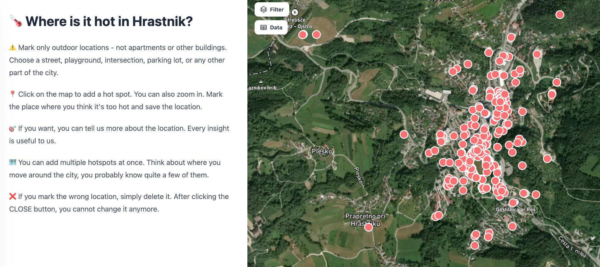
In June 2026, Hrastnik launched their public call: "Where in Hrastnik is it too hot in summer?" Residents were invited to Mapperoni to mark the paths, streets, and public spaces where summer heat is the worst. The best part: no complicated account setup, no GIS training, no PDF forms. Anyone with the link could drop a pin and offer their feedback.
Their digital campaign was paired with old-fashioned street presence, too. On June 23, the project team set up in the town center, collecting suggestions in person (as well as handing out ice cream).
Why this model works
This is participatory GIS (PPGIS) doing what it does best:
Residents contribute where they are in seconds. The barrier to participation is a link, not complicated software. That matters a lot for reaching people in the moment and not overcomplicating the objective.
The municipality gets structured data, not a comment inbox. Every submission is a georeferenced point that can be analyzed, clustered, and compared against other data layers. The alternative is usually a pile of emails someone has to transcribe.
The feedback loop is real. Hrastnik was keen to analyze the most exposed areas and develop heat-mitigation proposals for them. The city also committed to physically redesigning or equipping at least one location with cooling measures. Residents weren’t just being surveyed; they were pointing where to take action.
Results
The results were quite insightful. All in all, by the end of August, 436 residents were able to designate hot spots in their local community and add their own insights. Thanks to Mapperoni, this simple yet elegant solution allowed the town’s residents to voice their feedback without tripping over technical barriers.
The bigger picture
Across Europe, LIFE-funded adaptation projects are pushing municipalities towards the same question. That is, how do you gather genuinely local climate knowledge at scale? Heat mapping in Hrastnik is one answer, but the same pattern applies to flood-prone spots, missing bike infrastructure, accessibility barriers, neighborhood green-space planning, and so on.
The common thread is an easy tool that treats residents as sensors and stakeholders. That's what Mapperoni was built for.
Running a participatory mapping project for your municipality or organization? See how Mapperoni works.